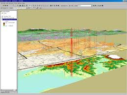
The prime aim of this article is to discuss about geographic information systems. Geographic Information Systems, or GIS, usually are systems that gather, organize and analyze data regarding its geographical location. GIS mapping uses software to register data via land surveys, aerial and satellite photography, as well as a wide variety of other sources. This files is then combined and represented in map style.
About Geographic Information Systems