Analyzing the Bandarban district of Bangladesh:
Task 1: Generate a ‘district_boundary.shp’ using the given map (thana490). Calculate your district area in sq. kilometer.
Procedure: At first the shape file of “thana 490” has been added to the Table of Content (TOC), then the shape file was projected under the BTM Coordinate system and the measurement unit was meter.
- Select the Bandarban district: The assigned district (Bandarban) was selected by the following method-
Thana 490 Open Attribute Table (Right click)
Option Select by Attributes
“Distname” = “Bandarban” (by double clicking)
Apply Ok.
- Generating the “district_boundary.shp”: To generate the “district_boundary.shp” at first the thanas of the Bandarban district was dissolved by the following procedure:
Arc Toolbox Data Management Tools Generalization Dissolve input = “thana 490” output = “district_boundary” Distname Apply Ok.
In this way the “district_boundary” shape file has been created.
- Calculating the area of the district:
District_boundary (TOC) Open Attribute Table (Right click) Option Add field
Name = “Area”, Type = “Float”, Field Properties: Precision= 50, Scale = 2 Ok.
By right clicking on the field “Area” in the Attribute Table, the option “Calculate Geometry” was selected. Then the unit was selected as “Square Kilometer”. As a result the area of the district Bandarban was found.
Output: The area of Bandarban District is 4595.41 Sq. Km.
Interpretation: Bandarban is a district in South-Eastern Bangladesh. It is bounded by Rangamati district on the north, Arakan (Myanmar) and the river naf on the south, Arakan and Rangamati district on the east and Chittagong and cox’s bazar district on the west. This district mostly consists of forests and hills. The three highest peak of Bangladesh – Tahjindong, Mowdok Mual and Keokradong are located in this district, as well as Raikhiang Lake, the highest lake in Bangladesh. Chimbuk peak and Boga Lake are two more highly noted features of the district. Parts of the biggest lake in Bangladesh – Kaptai Lake also fall under the area of Bandarban. In this district there are seven thanas – Bandarban Sadar, Rowangchhari, Ruma, Lama, Thanchi, Alikadam and Naikhongchhari. (Map: 1)
Task 2: Extract your district information from the supplied map of growth center of Bangladesh (LGED_GC.shp). Make a thana-wise lists of the GC in your study area. For spatial planning and donation purpose in your district, find out the growth center which covers all the following conditions- i. 12 kilometer away from District Headquarter (use ‘headquarter.shp’)
- 18 kilometer away from the national and regional highway (use ‘Road.shp’)
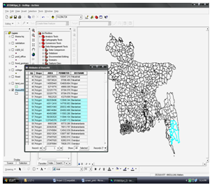
Procedure: First the shape file of “LGED_GC” has been added to the TOC and then the projection was done.
- Thana-wise lists of Growth Center: This was done with the help of “Selection” tool from the Menu bar.
Selection Select by Location I want to –
“Select features from”; Layers- “LGED_GC”;
That- “are completely within”; the feature in this
Layer- “district_boundary” Apply Ok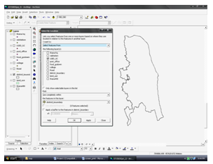
Then the selected features from the shape file
“LGED_GC” were exported and the new exported file was named as “Bandarban_GC”.
( This step is shown in Fig. no. 03)
Bandarban_GC (TOC) Open Attribute Table (Right Click) Option Export.
Table 1: Thana-wise List of Growth Centers in Bandarban
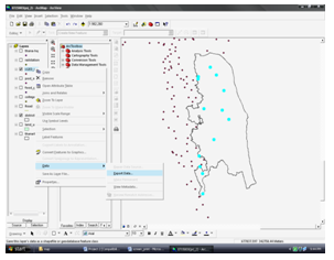
Table 1: Thana-wise List of Growth Centers in Bandarban
| NAME | THANAME |
| Thumbru Bazar | Naikhongchhari |
| Nuton Bazar Chakdala | Naikhongchhari |
| Naikhongchhari Bazar | Naikhongchhari |
| Baishari Bazar | Naikhongchhari |
| Alikadam Bazar | Alikadam |
| Thanchi Bazar | Thanchi |
| Bolipara Bazar | Thanchi |
| Daluchari Bazar | Lama |
| Ruma Bazar | Ruma |
| Suwalok Bazar | Bandarban Sadar |
| Raicha Bazar | Bandarban Sadar |
| Rowangchhari Bazar | Rowangchhari |
| Bagmara Bazar | Rowangchhari |
- 12 kilometer away from District Headquarter:
- The Shape file of “thana-hq” has been added to the TOC. By right clicking on “thana-hq” the
- option “Properties” was selected. Then using the tool “Symbology” it was symbolized by
it’s type as “DHQ” and “THQ”.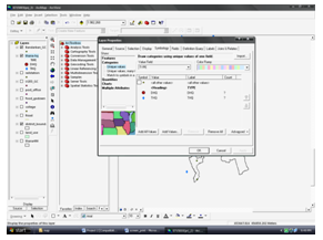
- Again using the “Select by Location” from the tool “Selection” from Menu bar, those thana headquarters were selected that were completely within the district_boundary. After that the “thana-hq” was exported, which was named as “Bandarban_HQ”.
- The District Headquarter of Bandarban was selected from the shape file “Bandarban_HQ” by using the tool “Select by Attribute” from the Attribute Table. After the selection it was exported as “Bandarban_DHQ”.
- Using the tool “Switch Selection” from “Option” in Attribute Table the selection was switched from District Headquarter to Thana Headquarters. After that it was exported as “Bandarban_THQ”.
- With the aid of “Select by Location” from the tool “Selection” from Menu bar, the Growth Centers were selected that were within a distance of 12,000 meter from the District Headquarter by applying a buffer. Before doing it the District Headquarter was selected from the Attribute table so that the option of “Use selected features” remains switched on.
- Using “Switch Selection” from the attribute table the Growth centers that were 12 km away from the District Headquarters was founded. Then it was exported named “12 km_DHQ”.
- 18 kilometer away from the National and Regional Highway:
- Clipping the Road: The shape file of “Road” has been added to the TOC.
Arc Toolbox Analysis Tool Extract Clip Input features = “Road”; Clip features = “district_boundary”; Output feature class = “Road_clip” Ok.
- Creating Buffer:
Arc Toolbox Analysis Tool Proximity Buffer Input features = “Road_clip” ; Output feature class = “Road_clip_buffer1”; Distance: Liner unit = 18000 m; Dissolve type (Optional) = “All” Ok.
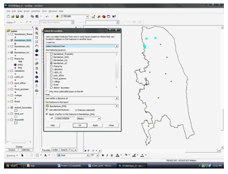
- Using Select by Location:
Selection Select by Location I want to – “Select features from”; Layers- “12 km_DHQ”; that- “are completely within”; the feature in this Layer- “Road_clip_buffer1” Apply Ok.
Select “12 km_DHQ” (TOC) Open Attribute Table Option Switch Selection.
After removing the layer “Road_clip_buffer” from TOC the file named “12 km_DHQ” was exported as “12 km_18km_GC”.
- Preparing the map: By making only the district_boundary, Bandarban_DHQ, Road_clip and 12 km_18km_GC layer visible, Layout View was opened where map title, legend, scale, north sign and graticule was added to the map. Later the layers Bandarban_DHQ, Road_clip and 12km_18km_GC were renamed as “District Headquarter”, “National Highway” (as there was no Regional Highway in the district) and “Growth Center” respectively. A final layout for printout was prepared.
Output: There were six Growth Centers which are both 12 km away from the District Headquarter and 18 km away from the national and regional highway.
Interpretation: There are thirteen Growth centers in Bandarban district. All of them are Bazars. Out of thirteen Growth centers the maximum number of them (four) is situated in Naikhongchhari thana. Bandarban Sadar, where the District Headquarter is located, has two Growth centers. Again Rowangchhari thana and Thanchi thana has two Growth centers each. And Alikadam, Lama, Ruma Thanas have one Growth center each. There are ten growth centers which are 12 km away from the District Headquarter. In this district only National Highway has been found out. Few growth centers are located very close to the National Highway. As the number of Growth centers are six which are both 12 km away from the District Headquarter and 18 km away from the National Highway, so it can be understood that there are seven growth centers which are within 12km from the District Headquarter and within 18 km from the National Highway. So donation works can be conducted quite easily within 12 km and 18 km radius from the district headquarter and national highways respectively. (Map: 2)
Task 3: a. Prepare three maps of food godown (supplied map of food godown) on the basis of
the following criteria:
- Make a zone of accessibility of 8, 12 and 16 kilometer from the national or regional road in your area.
- The godown are within 10 kilometer from District Headquarter
- Make a thana-wise list of the godown with their capacity.
Procedure:
a(i) The shape file of “food_godown” has been added to the TOC.
- Selecting the food godown within the district:
Selection Select by Location I want to – “Select features from”; Layers- “food_godown” that- “are completely within”; the feature in this Layer- “district_boundary”
Apply Ok.
After this selection the layer “food_godown” was exported as “Bandarban_food”.
- Creating accessibility zone Using Multiple Ring Buffer:
Arc Toolbox Analysis Tool Proximity Multiple Ring Buffer Input features = “Road_clip”; Output feature class = “Accessibility zone from the National Highway”; Distances = “8000 + 12000 + 16000” Ok.
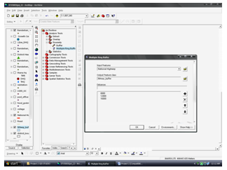
By right clicking on “Accessibility zone from the National Highway” the option “Properties” was selected. Then using the tool “Symbology” all the values of the field “Distance” was added and it was symbolized by it’s distances.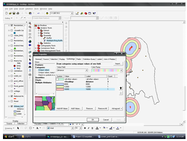
- Preparing the map: To prepare this map only district_boundary, National Highway, Bandarban_food and Accessibility zone from the National Highway layers were kept visible in the TOC. The map title, legend, scale, north sign and graticule was added. Later the layers Bandarban_food were renamed as “Food Godown”. A final layout for printout was prepared.
Interpretation: There were total eight Food Godowns in the Bandarban District. Of them, two food godowns were located within 8 km from the National Highway (one is in the Bandarban Sadar and the other one is in the Lama thana). The 8, 12 and 16 km zone of accessibility all cover these two food godowns. Except these two, no other food godown falls within 12 km from the National Highway. But with the previous food godowns one also is located within the accessibility zone of 16 km from the National Highway, which is in the Rowangchhari thana.
The rest of the five food godowns did not fall in the required accessibility zones. So it can be said that only a small number of of the food godowns are easily accessible by the national highway. (Map: 3)
a(ii) Selecting the food godown: Select District Headquarter from the attribute table.
Selection Select by Location I want to – “Select features from”; Layers- “Bandarban_food”; that- “are within a distance of”; the feature in this Layer- “District Headquarter”; Apply a buffer to the features in District Headquarter of = 10000 meter
Apply Ok.
Then “Bandarban_food” was exported with the selection.
- Preparing the map: To prepare this map only district_boundary, District Headquarter, Food Godown and 10 km buffer from District Headquarter layers were kept visible in the TOC. The map title, legend, scale, north sign and graticule was added. A final layout for printout was prepared.
Output: There is one food Godown within 10 km from the District Headquarter.
Interpretation: The go downs are located far away from each other. The food Godown within 10 km from the District Headquarter is located on Bandarban Sadar having the highest capacity. So, out of eight food godowns only one is within 10 km from the District Headquarter. And the rest of the godowns are far away from the District Headquarter. (Map: 4)
b. Procedure:
Bandarban_food (TOC) Open Attribute Table Option Export.
Table 2: Thana-wise List of Food Godowns in Bandarban District
| Thana Name | Total Capacity (Metric Ton) |
| Bandarban Sadar | 1300 |
| Lama | 650 |
| Lama | 1300 |
| Rowangchhari | 650 |
| Naikhongchhari | 650 |
| Alikadam | 650 |
| Ruma | 650 |
| Thanchi | 650 |
Interpretation: The food godowns that are located in Bandarban Sadar and Lama thana have the highest capacity. Only Lama thana has two food go downs and the rest of the six thanas have one food godown each. The total capacity of eight food godowns is 6500 Metric ton.
Task 4: Generate a map of your study district showing its land use pattern and following
infrastructure: i. District and Thana headquarter ii. Growth Center iii. Roads iv. Rail Station v. Post Office
Procedure: The shape file of “land_use”, “Road” and “Post Office” has been added.
- Clipping the Land use:
Arc Toolbox Analysis Tool Extract Clip Input features = “land_use”; Clip features = “district_boundary”; Output feature class = “Land use pattern” Ok.
By right clicking on “Land use pattern” the option “Properties” was selected. Then using the tool “Symbology” all the values of the field “Mainuse” was added and it was symbolized by it’s Main use.
- Rail station:
Selection Select by Location I want to – “Select features from”; Layers- “railstation” that- “are completely within”; the feature in this Layer- “district_boundary” Apply Ok.
No rail station was found in the Bandarban District.
- Post Office:
Selection Select by Location I want to – “Select features from”; Layers- “post_office” that- “are completely within”; the feature in this Layer- “district_boundary” Apply Ok.
Then it was exported as “Bandarban_PO”
- Preparing the map: district_boundary, District Headquarter, Bandarban_THQ, National Highway, Bandarban_PO, Bandarban_GC and land use pattern layers were kept visible in the TOC. Later the layers Bandarban_THQ, Bandarban_PO and Bandarban_GC have been renamed as “Thana Headquarter”, “Post Office” and “Growth Center”. After assigning appropriate symbols and colours for the required layers the map title, legend, scale, north sign and graticule was added. A final layout for printout was prepared.
Output: A map with the land use pattern, District and Thana headquarter, Growth Center, Roads, Rail Station and Post Office is prepared.
Interpretation: Majority of the land of this District has been used as forest, as it is one of the three hill districts of Bangladesh and a part of the Chittagong Hill Tracts. Less than 1% of the land is used as Transplanted Aman rotation. The District Headquarter is located in the Bandarban Sadar. There are six Thana Headquarters, located in the other six thanas except Bandarban Sadar. In case of road, only National Highway was found in this district. Six Post Offices was found here, of them one was located in the Bandarban Sadar (District Headquarter) and some of them were located very close to few thana Headquarters. No railway station was found here. So it means that the only route is by road. The number of growth center that was found in this district was thirteen. They were situated evenly throughout the district. (Map: 5).