A new map of the Schrodinger basin, a geologically significant area of the moon, that includes rover paths, could help guide future exploration missions. A team of interns at the Lunar and Planetary Institute created the map, including Ellen Czaplinski, a University of Arkansas graduate student researcher at the Arkansas Center for Planetary Sciences and first author of a paper published in The Planetary Science Journal.
A new map of the moon’s Schrodinger basin could aid in the planning of future exploration missions. NASA funded the map project, which was created by a team of researchers that included a graduate student from the University of Arkansas. A new map of the moon’s Schrodinger basin could aid in the planning of future exploration missions. NASA funded the map project, which was created by a team of researchers that included a graduate student from the University of Arkansas.
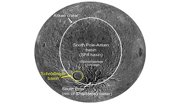
The geologic features of the Schrödinger basin, which is located near the lunar south pole, were identified by the researchers. Schrödinger is the moon’s second-youngest impact basin, with a diverse range of crustal features and rock types important for understanding the moon’s geological history.
A new map of the Schrodinger basin of the moon could help guide future exploration missions. The researchers identified significant geologic features of the Schrödinger basin, located near the lunar South Pole.
To understand the formation and characteristics of the basin, samples of the rock types exposed in the basin’s peak ring are required. The peak ring is a ring-like boundary structure formed when a celestial body collided with the lunar surface, causing an uplift in the surrounding surfaces.
“Some of these lithologies (the general physical characteristics of the rocks) may have been uplifted from very deep beneath the lunar surface when the Schrödinger basin was formed,” Czaplinski said. “As a result, investigating these rocks up close is critical for answering high-priority science goals.”
The National Research Council outlined the scientific objectives and goals of future lunar missions in 2007, including the exploration of the South Pole-Aitken basin, the moon’s oldest and deepest impact basin. Because the Schrödinger basin is located within the South Pole-Aitken basin, it provides a unique opportunity to study rocks that may have formed deep beneath the surface, according to Czaplinski.
“Many of these rock types are visible at the surface in multi-kilometer-long exposures of rock outcrops in Schrödinger’s ‘peak ring,’ an inner ring of uplifted rocks formed with the basin. The sampling of these rocks within the peak ring has a high scientific potential for furthering our understanding of the context of Schrödinger’s lithologies.”
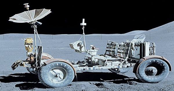
Along with the map, the researchers devised three potential paths for robotic rovers to take to collect high-priority rock samples in the Schrödinger basin. NASA’s Solar System Exploration Research Virtual Institute funded the students’ research at the Lunar and Planetary Institute.
The sampling of these rocks in the peak ring has a high scientific potential for furthering our understanding of Schrödinger’s lithological background. The researchers created three potential paths for the robotic rover to travel through the Schrodinger Basin to collect high-priority rock samples while drawing the map.
The first wave of lunar exploration focused on gathering information needed to safely land humans on the Moon and return them to Earth, whereas the initial exploration of other objects focused on a simple reconnaissance of unknown surfaces. After completing the initial reconnaissance of an object, more focused and directed science questions and goals could be developed.