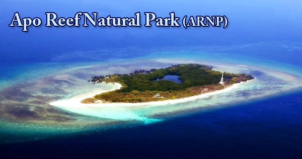
The Apo Reef is the largest atoll-type reef in the Philippines, found in the western waters of the Occidental Mindoro province in the Mindoro Strait, and is a coral reef system in the Philippines. It extends over an area of 13 sq mi (34 square kilometers), making it the world’s second-largest linking coral reef (the first place being occupied by the Great Barrier Reef of Australia). Its crystal-clear waters, including 285 fish species and 197 coral species, abound with life. With sightings of white-tip and black-tip sharks, coral sharks, wrasses, jacks, and tuna all popular, it’s a wonderland for divers and snorkellers. In the country administered as the Apo Reef Natural Park (ARNP), the reef and its surrounding waters are protected areas. It is one of the country’s best-known and most famous diving sites. It is listed on the UNESCO World Heritage Sites Tentative List.
The three islands constitute the Apo Reef Natural Park. Amongst the three islands, Apo Reef is the biggest. It has a shallow lagoon 2 meters to 10 meters deep, surrounded by a mangrove forest that serves as a source of food, nursery, and spawning ground for many species of coastal and marine fauna and bird sanctuary. Apo Reef is approximately 15 nautical miles (28 km; 17 mi) west of the nearest coast on the island of Mindoro, Philippines. It is isolated from the main island by the Mindoro Strait’s Apo East Pass. 285 species of colorful marine life, including tropical aquarium fish, snappers, and the crevice-dwelling moray, fill the bright blue waters of the river. It’s one of the world’s best diving spots, drawing crowds of divers all year round.
(Apo Reef Natural Park)
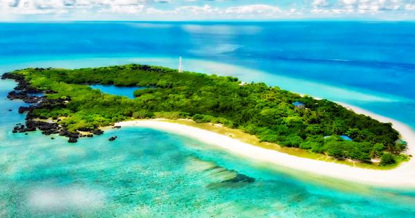
Apo Reef is approximately 26 kilometers (16 mi) from the north to the south tip of a triangular coral atoll formation, and 20 kilometers (12 mi) from east to west. The north and south lagoons, which are bordered by small reef platforms, are separated by two lagoon systems. The Apo Reef’s key geological features are submerged. The Apo Island, Apo Menor (Binangaan’; and Cayos del Bajo Tinangkapang), are three islands that mark it on the surface. The largest is Apo Island (22.0) with mangroves and beach vegetation, while Binangaan is a rugged Limestone Island with relatively little vegetation and Cayos del Bajo (200-300 sq.m.) is a vegetation-free coralline rock formation.
When the seas are flattest, during April, May, October, and November, the best time to make the journey to Apo Reef. During the windy December to March season, the journey is very rough. At the height of the southwest monsoon (July-September), it is always impractical to fly to the reef and be sure to call ahead of any operator’s shutdown. The island houses a permanent base of rangers that monitors the national park. The environmental fees are collected by an administrative desk. Subject to some circumstances, overnight stays in tents are possible. Onshore, very limited facilities are available to safeguard the delicate ecosystem of the island.
(View of Apo Reef)
The Apo Reef Natural Park (ARNP) and its Buffer Zone peripheral region occupy an area of 15,792 hectares and 11,677 hectares, for a total of 27,469 hectares. The reef’s main operation refers to its underwater consistency. Due to the consistency of the flora, the fauna, and the visibility of the water and white sand, scuba diving and snorkeling in the Apo Reef area are exceptional. In deep or shallow waters, many species can be observed particularly sharks, giant napoleons, and manta rays.
Information Sources: