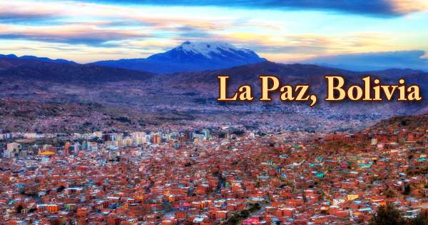
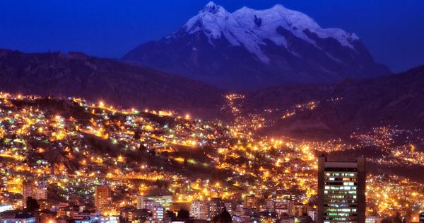
La Paz is one of the most exciting cities in South America to visit, offering numerous interesting sights, adrenaline-pumping activities, free events, and cool places to go out. La Paz (/lɑː ˈpɑːz/), officially known as Nuestra Señora de La Paz (Spanish pronunciation: ˈnwestɾa seˈɲoɾa ðe la ˈpas; English: “Our Lady of Peace”), also named Chuqi Yapu (Chuquiago) in Aymara, is the seat of government of the Plurinational State of Bolivia. It is the highest administrative capital in the world, resting at over 3,500m above sea level. In a bowl-like depression surrounded by the high mountains of the Altiplano, La Paz is situated. The towering, triple-peaked Illimani overlooks the area. Its peaks are still covered with snow and can be seen from many parts of the town.
La Paz, City, Bolivia
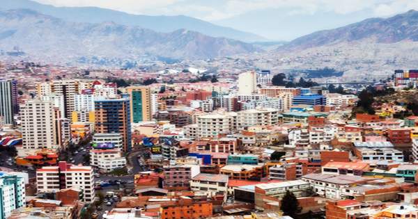
La Paz is located some 68 km (42 miles) southeast of Titicaca Lake. It is the third-most populated city in Bolivia, with an estimated 1,816,044 residents as of 2020. Its metropolitan area, made up of La Paz, El Alto, Achocalla, Viacha, and Mecapaca, is Bolivia’s second most populated urban area, with a population of 2.0 million, after Santa Cruz de la Sierra, with a population of 2.3 million. It is also the capital city of the Department of La Paz. At every turn, a jaw-dropping subway in the sky appears to reinvent itself, taking tourists from the heights of El Alto to the depths of Zona Sur in the blink of an eye. Standing hotels are remodeled at a manic rate, and like rows of altiplano maize, new boutique hotels spring up.
La Paz is the highest national capital in the world, lying between 10,650 and 13,250 feet (3,250 and 4,100 meters) above sea level. Visitors, due to the rarefied atmosphere at those elevations, frequently find exertion challenging upon arrival. La Paz has an extreme subtropical highland climate due to its elevation, with rainy summers and dry winters. The town of La Paz was established on 20th October 1548 on the site of the Inca settlement of Laja by the Spanish conquistador, Captain Alonso de Mendoza, as a connection point between the commercial routes from Potosí and Oruro to Lima; Originally, in commemoration of the restoration of peace following the uprising of Gonzalo Pizarro and fellow conquistadors against the first viceroy of Peru, the full name of the city was Nuestra Señora de La Paz (meaning Our Lady of Peace).
In a wide, large canyon created by the La Paz, or Choqueyapu, River, lies the center of the region. The location of the settlement, some 1,400 feet (430 meters) below the surface of the high intermontane plateau, the Altiplano, offers some protection from the cold winds of the highlands. The city was later relocated to its current location in the Chuquiago Marka valley. As part of the Río de la Plata Viceroyalty, La Paz was under Spanish colonial control, until Bolivia achieved independence. The city has been the scene of several revolts since its establishment. Population growth has extended the city up the canyon walls to the edge of the Altiplano since the latter part of the 20th century. La Paz was the most populous city in Bolivia until the turn of the 21st century when Santa Cruz overtook it.
![]()
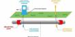
Cable car transit system in La Paz
The seat of public government was set up there in 1898, however, Sucre remains Bolivia’s protected capital, home to the nation’s Supreme Court; La Paz is the seat of the executive and legislative branches. On the northeast side of the river, Plaza Murillo is the center of the city and the location of an immense modern cathedral and government and legislative palaces. La Paz is Bolivia’s main political, administrative, commercial, and sports center; it produces 24 percent of the Gross Domestic Product of the nation and serves as the headquarters for numerous companies and industries in Bolivia. La Paz is also an important cultural center in Latin America, as it is home to many colonial-era landmarks, such as the Church of San Francisco, the Metropolitan Cathedral, Plaza Murillo, and Jaén Lane.
Although few colonial buildings remain, with Nevado Illimani (21,004 feet (6,402 meters)) and other snowcapped peaks of the Cordillera Real in the background, the narrow, steep, older streets, red-tile roofs, many skyscrapers, and highland Indians in colorful dress give La Paz a distinctive atmosphere. The city is renowned for its unique markets and for its vibrant nightlife, especially the Witches’ Market. From various natural vantage points, its peculiar topography provides unique views of the city and the surrounding Cordillera Real Mountains.
A must-visit museum featuring Bolivian culture’s rare artifacts. The museum is located in the magnificent 18th century Marquis de Villa Verde Building, a relatively new Bolivian colonial estate. Get lost among ancient masks and discover the significance behind traditional textiles. The museum also distributes fantastic audio-visual projects that celebrate the history and traditions of Bolivia that are very much alive to this day. Also, La Paz is host to the world’s largest urban cable car network. It is the site of San Andrés University (1830) and the Catholic University of Bolivia (1966).
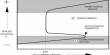
Among the cultural assets of the city are the National Museum of Art, the Children’s Museum, the Museum of Ethnography and Folklore, the National Museum of Archaeology, and the Mercado de Brujas (‘Witches’ Market’), which sells herbs and other remedies used by the Aymara. One of the most prominent landmarks in La Paz is the Basílica de San Francisco. Explore the rare combination of colonial and indigenous architecture; enjoy the views from the top of the church on the rooftops of the city. One of the most loved locations in La Paz must be Valle de la Luna or the Moon Valley. The Moon Valley is literally a place of wonder, a maze of giant spires and canyons, made principally of clay and sandstone. While there is also a camping area for anyone wishing to stay overnight, the walk along the valley is about 45 minutes long.
The Moon Valley, La Paz, Bolivia
The temperatures in the focal La Paz, at 3,600 meters (11,811 feet), and in the Zona Sur (Southern Zone), at 3,250 m (10,663 ft) above ocean level. An earthquake in July 1994 rated at 8.2 struck 200 miles (322 km) north of La Paz. It could be felt near La Paz, causing damage in the area’s villages. Industries in La Paz are primarily food processing and textile manufacturing, clothes, shoes, and chemicals. The city is linked to the seaports of Peru and Chile, and also to Argentina and Brazil by railways and highways.
Information Sources: