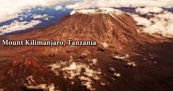
Mount Kilimanjaro (/ˌkɪlɪmənˈdʒɑːroʊ/) is Africa’s highest peak and one of the continent’s seven summits; it is a dormant volcano in Tanzania. Kibo, Mawenzi, and Shira are its three volcanic cones. Kibo, the center cone, rises to 19,340 feet (5,895 meters) and is Africa’s highest peak. It stands at 5,895 meters (19,341 feet) above sea level and roughly 4,900 meters (16,100 feet) above its plateau base, making it Africa’s tallest peak and the world’s highest single free-standing mountain.
Because it is the simplest of the seven peaks, Kilimanjaro is highly popular with both expert hikers and first-time explorers. Every year, over 25,000 individuals attempt to conquer Mt. Kilimanjaro. Approximately two-thirds of the applicants are successful. The most common reason climbers return is because of altitude-related issues. Kilimanjaro is roughly 140 miles (225 kilometers) south of Nairobi, Kenya, and about 100 miles (160 kilometers) east of the East African Rift System.
Kilimanjaro is the world’s fourth-highest peak, located in Tanzania’s Kilimanjaro National Park and a popular climbing destination. There are no technical skills or equipment required to climb the mountain, such as a rope, harness, crampons, or ice axe. As a result, it is classified as a hiking or “walk-up” summit rather than a mountaineering or climbing peak. It has been the focus of several scientific research due to its decreasing glaciers and ice fields, which are expected to vanish between 2030 and 2050.
Mount Kilimanjaro wasn’t always a tourist destination, and it didn’t even exist at one point. Huge pressure drove molten rock from the earth’s crust via a major fault line that runs through East Africa to reach the earth’s surface about 1 million years ago, forming the Great Rift Valley. Kilimanjaro is the world’s tallest free-standing mountain, as well as Africa’s tallest peak. Uhuru Point, at 5,895 meters (19,341 ft) above sea level, is the highest point on the mountain.
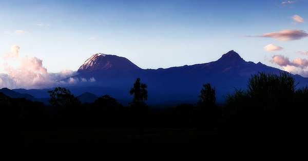
The mountain has almost every type of biological system, including cultivated land, rain forest, heath, moorland, alpine desert, and an arctic peak. The origin of the name Kilimanjaro is unknown, however, there are several possibilities. By 1860, European explorers had adopted the name and claimed that the mountain’s Kiswahili name was Kilimanjaro. The mountain is also known as Kilima-Njaro, according to the 1907 edition of The Nuttall Encyclopaedia. The massif stretches 50 miles (80 kilometers) east-west and is made up of three main extinct volcanoes: Kibo in the center, Mawensi in the east, and Shira in the west.
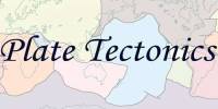
Most high mountains are part of a range, such as the Himalayan Mountain Range, which includes Mount Everest. Plate tectonics is the process that creates them. The Earth’s crust is made up of numerous tectonic plates underneath the surface. Geologic action has caused these plates to move from the beginning of time. Based on a British study in 1952, the Tanzania National Parks Authority and the United Nations Educational, Scientific and Cultural Organization estimate the height of Uhuru Peak to be 5,895 meters (19,341 feet).
Since then, the height has been recorded at 5,892 meters (19,331 feet), 5,902 meters (19,364 feet), and 5,899 meters (19,354 feet) in 1999, 2008, and 2014. Land cracked, split, and sunk to form a massive basin, and the push of this core pressure led volcanoes to arise, the most prominent of which are Shira, Mawenzi, and Kibo. The volcanoes grew over thousands of years, reaching a height of about 5000 meters before Shira collapsed into a caldera and became dormant some 500,000 years ago. The most recent eruption occurred around 200 years ago, while the most recent big eruption occurred 360,000 years ago.
Kilimanjaro’s volcanic interior is little known due to a lack of substantial erosion that has exposed the igneous layers that make up the volcano’s structure. Kibo continued to erupt, with the most recent being approximately 360,000 years ago, when rivers of black lava rushed down its slopes, filling Shira’s caldera and around and around the foot of Mawenzi to form what is now known as “The Saddle.” Eruptive activity at the Shira core began around 2.5 million years ago, with the final major episode happening immediately before the northern portion of the structure collapsed about 1.9 million years ago.
Around 1 million years ago, both Mawenzi and Kibo began erupting. The Saddle Plateau, at an elevation of 4,400 meters (14,400 feet), separates them. Kibo has sunk through time, and approximately 100,000 years ago, a large landslide ripped through the mountain’s side, forming a 300-meter-deep canyon (or barranco), which is today known as Barranco Valley. At Mawenzi, the oldest dated rocks are 448,000 years old. On the mountain’s northeastern flank, the East and West Barrancos are also noteworthy.
Erosion has destroyed the majority of the mountain’s eastern side. Neumann Tower, at 4,425 meters, is a subsidiary summit of Mawenzi (14,518 ft). When plates collide, the edges collapse, launching chunks of rock into the air. Fold mountains, which are the most frequent form of a mountain, are termed as such. A fault (crack) in the Earth’s crust forces blocks of rock up between two tectonic plates, forming a fault-block mountain range. A portion of Kibo’s crater rim fell around 100,000 years ago, forming the Western Breach and the Great Barranco.
Mount Kilimanjaro is located in Tanzania, approximately 205 miles from the equator. People did not trust early explorers who reported seeing glaciers on the summit of Kilimanjaro because they believed ice could not develop so close to the scorching, tropical sun. Scientists now believe that during the planet’s ice ages, glaciers decrease and then rebound. In 2001, Italian Bruno Brunod completed the fastest confirmed ascent of Mt. Kilimanjaro, summiting Uhuru Peak in 5 hours 38 minutes 40 seconds. In 2004, local guide Simon Mtuy set the record for the quickest roundtrip, going up and down the peak in 8:27.
Kilimanjaro is drained by a network of rivers and streams, particularly on the wetter, more eroded southern side and above 1,200 meters (3,900 ft). Mount Kilimanjaro is a stratovolcano, a huge volcano composed of ash, lava, and rock. The ash pit is a two-hour round-trip trek from Crater Camp, the highest campground. The stench of sulfur from the volcano’s lava will welcome visitors at the ash pit. Large animals are uncommon on Kilimanjaro, however, they can be found in the woods at lower elevations. On Kilimanjaro, natural forests span around 1,000 square kilometers (250,000 acres).
Information Sources: