A portion of the western North Pacific Ocean, the Sulu Sea (Filipino: Dagat Sulu; Tausug: Dagat sin Sūg; Chavacano: Mar de Sulu; Cebuano: Dagat sa Sulu; Hiligaynon: Dagat sang Sulu; Karay-a: Dagat kang Sulu; Cuyonon: Dagat i’ang Sulu; Malay: Laut Sulu). It is bordered on the southwest by northeastern Borneo, on the west and northwest by the southwest islands of the Philippines, including Palawan, on the north by Busuanga and Mindoro, on the east by Panay and Negros, and on the southeast by Mindanao and the Sulu Archipelago. There are no passages below the depth of 500 m and the basin, which is 5,000 m deepest, is filled with low-oxygen warm water.
It fills a downgraded block about 490 miles (790 km) from north to south and 375 miles east to west, with a surface area of 100,000 square miles (260,000 square km), nearly 18,400 feet (5,600 meters) deep in some areas, the edges of which are seen in the bordering islands. A number of islands belong to the Sulu Sea. The Cuyo Islands and the Cagayan Islands are part of the Palawan Province, while the Tawi-Tawi Province contains Mapun and the Turtle Islands. The Tubbataha Reef National Marine Park, one of the World Heritage Sites, is also in the Sulu Sea.
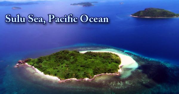
(Sulu Sea, Pacific Ocean)
The Sulu Sea has long been a kidnapping and ship-hijacking hotspot. Such actions and their many variations are said to have occurred against the Spaniards during their invasion of the Philippines by various actors as early as the 16th century. Up until the 20th century, due to the long-running war between the Moro people and Spain and subsequent conflicts in the same space piracy in the Sulu Sea and its surrounding areas, it went unabated. An extension of the Sulu Sea is the Panay Gulf. The Iloilo Strait, the Guimaras Strait, and the Basilan Strait are situated off the Sulu Sea.
The coral atolls surrounding Mapun (Cagayan Sulu) island, the Tubbataha Reefs, and the volcanic Mapun island group itself show a fracture line, bisecting the sea from northeast to southwest. The surface area of the sea is 260,000 square kilometers (100,000 sq mi). In northern Mindanao and between the archipelago of Sangihe talaud, North Sulawesi, the Pacific Ocean flows into the Sulu Sea. In recognition of their abundance and diversity of marine life, the Tubbataha Reefs have declared a UNESCO World Heritage Site in 1993; the site’s borders were extended to triple its original size in 2009.
The Sulu Sea is described by the International Hydrographic Organization (IHO) as being one of the waters of the Archipelago of East India. Today, the sea is commonly used for inter-island trade. Fishing is important and pearls, pearl shells, bêche-de-mer (trepang), shark fins, and turtle eggs are marine items. Among sport-diving enthusiasts, the reefs of the Sulu Sea are internationally renowned. Hikaru Sulu, a Star Trek character, is named after the Sulu Sea. The central region can still be described as a dessert, although the Sulu Sea is more active than the neighboring South China Sea. It seems that the projections of new primary development in the central Sulu Sea are only adequate to sustain existing fisheries.
Information Sources: