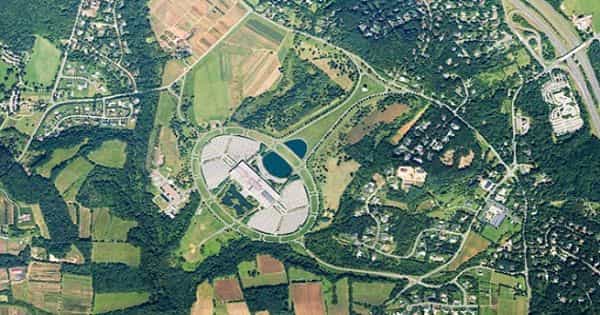
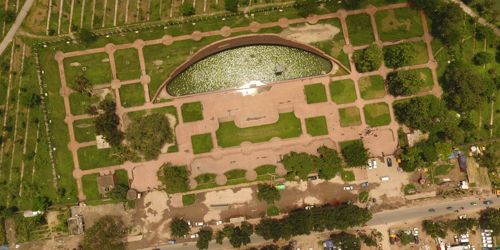
Aerial photography is a technique of photographing the Earth’s surface or features of its atmosphere or hydrosphere with cameras mounted on aircraft, rockets, or Earth-orbiting satellites and other spacecraft. It is airborne imagery, is the taking of photographs from an aircraft or other flying object. Each photograph depicts an area that includes several control points, the locations of which are determined by ground-surveying techniques. It is any photograph taken from the air, such as a photograph of a part of the Earth’s surface taken by a camera mounted in an aircraft. It was first practiced by the French photographer and balloonist Nadar in 1858.
Aerial Photography is an art, science, and technology of taking aerial photographs from an airborne platform. Aerial photographs are used in topographical mapping and interpretation.
Aerial photography is the taking of photographs from above with a camera mounted, or handheld, on an aircraft, helicopter, balloon, rocket, kite, skydiver, or similar vehicle. Platforms for aerial photography include fixed-wing aircraft, helicopters, unmanned aerial vehicles (UAVs or “drones”), balloons, blimps and dirigibles, rockets, pigeons, kites, parachutes, stand-alone telescoping, and vehicle-mounted poles. It is the activity or technique of photographing the earth’s surface from an aircraft, rocket, etc; such photographs collectively.
The basic advantages that aerial photographs offer over ground-based observation are :
- Improved vantage point: Aerial photography provides a bird’s eye view of large areas, enabling us to see features of the earth’s surface in their spatial context.
- Time freezing ability: An aerial photograph is a record of the surface features at an instance of exposure. It can, therefore, be used as a historical record.
- Broadened Sensitivity: The sensitivity of the film used in taking aerial photographs is relatively more than the sensitivity of the human eyes.
- Three Dimensional Perspective: Aerial photographs are normally taken with uniform exposure interval that enables us in obtaining stereo pair of photographs.
Aerial photography is used in cartography, land-use planning, archaeology, movie production, environmental studies, espionage, commercial advertising, conveyancing, and other fields. Mounted cameras may be triggered remotely or automatically; hand-held photographs may be taken by a photographer. Other important concepts used in aerial photography are stereoscopic coverage, fiducial marks, focal length, roll and frame numbers, and flight lines and index maps.
Aerial photography involves taking photos from elevated platforms such as manned or remote-controlled aircraft or helicopters. It should not be confused with air-to-air photography, where one or more aircraft are used as chase planes that “chase” and photograph other aircraft in flight. It is one of the earliest forms of remote sensing and is still one of the most widely used and cost-effective methods of remote sensing.
Information Source: