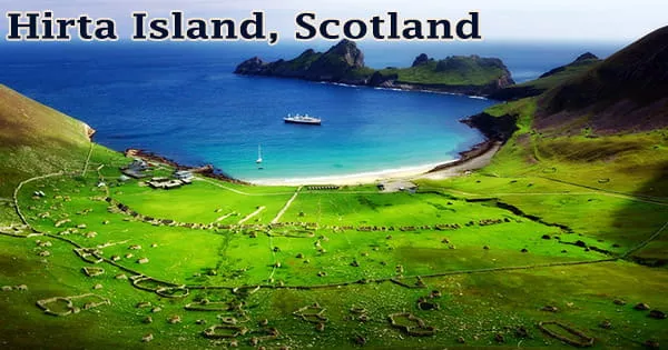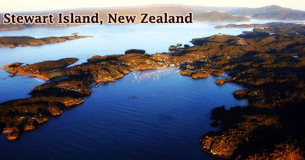
Stewart Island / Rakiura (Rakiura, lit. “glowing skies”, is the Māori name), is New Zealand’s third-biggest island, located in the southwest Pacific Ocean off the southern tip of South Island. It’s a wonderful hideaway for people seeking peace, quiet, and adventure, yet it’s only 30 kilometers from the South Island. Across the Foveaux Strait, the island is 30 kilometers (19 miles) south of the South Island. With a total land area of 1,746 square kilometers (674 sq mi), it is a roughly triangular island.
Stewart Island has a unique environment; although being subantarctic, the island’s brilliant turquoise water and white sand beaches give it the appearance of a tropical paradise. Paterson Inlet (east), Port Pegasus (south), and Mason Bay (west) crisscross the 164-kilometer (102-mile) coastline (west). The island is steep and thickly wooded, rising to 980 meters (3,220 feet) at Mount Anglem. Because there are few imported predators, flightless birds such as penguins flourish.
The island, which is somewhat triangular in shape and is 45 by 25 miles (70 by 40 kilometers), has a total land area of 674 square miles (1,746 square km). Its 102-mile (164-km) coastline is sharply divided by Paterson Inlet (east), Port Pegasus (south), and Doughboy and Mason bays. It is typically steep, peaking to 3,215 feet (980 meters) at Mount Anglem/Hananui, forested, and windy (west). According to the 2018 census, it has a permanent population of 408 people, the majority of whom live in the village of Oban on the island’s eastern side.
The Southern Lights, also known as the Aurora Australis, can be seen from the island on a daily basis, making it a beautiful destination for astrotourism and earning it the name Rakiura, which means “Land of Glowing Skies.” Rakiura is the Mori name that is most often used. It is sometimes interpreted as “Glowing Skies,” a reference to the aurora australis, or “Southern Lights,” a phenomena that occurs at lower latitudes.
The Mutton Bird Islands, which number in the hundreds, are located just offshore. Rakiura National Park, which covers around 85 percent of Stewart Island, is a wild and beautiful place. Capt. James Cook first saw Stewart Island/Rakiura in 1770, mistaking it for a South Island peninsula. A survey undertaken by Capt. William Stewart, one of the many whalers and sealers who visited the island at the period, contradicted this initial account in 1809.
“Stewart Island” was the official name for most of the twentieth century, and most New Zealanders still call it that. The Ngi Tahu Claims Settlement Act 1998 changed the name to Stewart Island/Rakiura, one of several modifications made as part of the Ngi Tahu treaty settlement. The island has approximately 280 kilometers of walking trails, making it a popular destination for trampers and hikers. Birding, fishing, sea kayaking, diving, and hunting are some of the other activities available.
The marshy valley of the Freshwater River dominates the north. The river starts on the northwest coast and runs southeast into Paterson Inlet, a huge indentation. The National Park covers almost 85% of the island, and the majority of visitors come for the trekking and birding. There are just 28 kilometers of road on the island, but there are 280 kilometers of hiking trails suitable for short walks, day treks, and multi-day excursions.
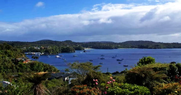
Stewart Island/Rakiura is a thinly inhabited island that survives on summer visitors and oyster and crayfish fishing. A ferry connects it to Bluff in South Island, crossing Foveaux Strait, which is about 17 miles (27 kilometers) wide. The boat arrives in Halfmoon Bay (previously Oban), the most southerly permanently populated settlement in New Zealand, on Stewart Island/Rakiura.
Around the shore, there are three big and several tiny islands. Ulva Island Te Wharawhara is a predator-free refuge on Stewart Island’s Paterson Inlet that is a must-see. Friendly Kākā and Weka, colourful Kākāriki, South Island Saddlebacks, tiny Blue Penguins, rare Yellow-Eyed Penguins Hoiho, and dozens of other natural species abound on the island, particularly Ulva Island. It’s the only site in New Zealand where visitors may observe Brown Kiwi in their native environment.
Fishing has long been the most significant part of Stewart Island’s economy, and while it still is, tourism has surpassed it as the primary source of revenue for the islanders. Farming and forestry have also been practiced. Oban’s main roadways are mostly paved, with some gravel roads on the periphery. Stewart Island features numerous beautiful beaches, including Bathing Beach, in addition to walking paths. Because of its protected surroundings, it’s a fantastic spot to go for a swim within a short walk from Oban’s village.
Information Sources: